Thursday, April 02, 2009

Adventures in Ecuador

Having given up the title of lonesome hobo, I continued you my travels with Tamara, in Ecuador.
Vilcabamba

After the challenging journey from Peru into Ecuador it was nice to spend a few days in Vilcabamba to relax. Going hiking and mountain biking. A small town with a large ex-pat population of mainly North Americans who arrived after photos of Vilcabamaba were published in The New York Times in the 1970's.


It´s known for it´s population of old people with many supposedly living to well over 100 years. The steady climate, beautiful surroundings and the mineral content in the water are all thought to be the cause. A poster advertising Vilcabamba shows an old man smoking a cigarette, mountains in the distance with the caption 'health and life', seems at odds to this.

Although very near the equator the climate was pleasant due to an altitude of 1800m. The road north to Cuenca stuck to the mountains and some very familiar looking countryside. Regimented plots of pine trees and open moorland reminded me of Scotland, later the rolling countryside could have been the Yorkshire Dales.

Ecuador has suffered from serious deforestation. The High Andes area we travelled through had only 1 to 2% of original forest remaining. The rate of deforestation in other areas is estimated at 300,000 hectares per year or around 3%, which is one of the highest rates in the world. The Amazonian areas are threatened by pollution from oil exploration.

The oil industry has been allowed to operate not only in national parks and reserves, but also in indigenous territories (This is the same for mining). Texaco spilled over 18 billion gallons of oil in the Ecuadorian Amazon during the 20 years it operated there and is responsible for a multi billion dollar toxic cleanup bill that affected communities and indigenous people have had to pursue this in the US courts since the Ecuadorian government was not interested in resolving this issue.

Cuenca

Cuenca was the first big city we visited in Ecuador. UNESCO designated it a World Heritage Sight and it´s considered the cultural capital of Ecuador. It´s a great city to visit, very pretty, good museums, good museums and felt very safe. There was a level of sophistication in some of the bars that would not have been out of place in a Big European city, but with cheap prices.


Cuenca is the place to buy a 'Panama Hat'. Yes the origin of the Panama Hat is in Ecuador and Monticristi to be precise, however there were many hat makers in Cuenca. The hat was wrongly named after they were exported to Panama for the workers building the canal. They were liked for there hard wearing and durable qualities. The proper name is 'Sombrero de paja toquilla' in English Straw Hat, doesn´t sound so good.


The towns of Gualaceo, Chordeleg and Sig Sig are near to Cuenca and made a good day trip on Sunday when they have their markets. Very colourful and many indigenous people in traditional dress.


A Typical bus journey in Ecuador

The journey in question is from Cuenca to Baños, a short journey in South American terms, but requiring a change of bus in Riobamba.

In Ecuador, it´s not really necessary to book ahead for a bus ticket. Just turn up at the bus station and the bus companies will have somebody calling out destinations and in less than a minute a ticket will be in your hand.

Onto the bus, with luggage in the storage area beneath, get your seat quick because nobody pays much attention to seat numbers on the tickets. If a parent and kids have taken your seat it´s not really right to ask them to move. However it´s not unusual to be the only one on the bus as it leaves the bus station. The local people avoid paying the departure fee in the bus station and get on at the road outside.

The buses are a little different from home. There is a partition between the driver and conductor and the passengers. This leads to a generally stress free journey in that it´s much better not being able to see what is happening on the road ahead. The buses are the fastest vehicles on the road having to drive at seemingly breakneck speeds to keep to their schedules, overtaking everything in their way whether safe to do so or not. The conductor stows your luggage, sells tickets on the bus and yells out the destination to people on the street. On one bus the conductor only had one leg. He used a crutch as a false leg and jumped on and off the bus while it was moving and ran up and down the aisle collecting fares faster than I could have.

The bus stops regularity to pick people up and the aisle is often full of people standing. It´s not possible to go hungry on the bus as it´s always stopping to pick sellers of food and drink, all calling out their goods. The other non paying passenger is the salesman, often selling vitamin supplements and may be dressed to look like a doctor. He´ll get off a the edge of town then flags a bus down going the other way.

After an uneventful six hours we arrived at Riobamba. Before we reach the bus station the conductor tells us it´s time to get off. There are two bus stations in Riobamba, the bus wasn´t going to where we would get the bus to Baños. Had we sixth sense we´d have crossed the road and waited for the bus to Baños, however the conductor never thought to tell us this.

A taxi stopped and said it would cost $1 to take us to the bus station on the other side of town. That was cheap as it was quite a distance away. At the bus station we buy our tickets and waited in the bus office for half an hour until the bus left. The conductor of the bus was advertising the journey with the cry of Baños, Baños, Baños, Baños hardly distinguishable in his high pitched wail and only interrupted by a whistle when a pretty girl walked past.

The bus left at 4pm shortly after passing where we had been dropped off earlier and then past rolling countryside with patchwork quilt fields and old volcanoes. Beautiful countryside but nothing we hadn´t seen before. Baños, we´d been told, was in a spectacular setting. Rounding a corner our jaws dropped as Volcan Tungurahua comes into view towering above Baños at 5023m.

Safely across a bridge built to cross a man made gully to direct lava from the volcano above, we arrived in Baños.

Baños

Volcan Tungurahua burst back in to action in 1999 are a long period of rest. The 25,000 people of Baños were temporarily evacuated. Recent activity in December 2008 had covered the road from Riobamba with ash and it had only recently been reopened. Probably wise to check the volcano activity websites before hand, but sometimes ignorance is bliss.


Baños (meaning bath in English and pronounced banyos) unsurprisingly, with all the volcanic actively in the area, has numerous thermal bath houses. We got a taxi to a bath house just out side of town, beneath the volcano, we were the only tourists there sharing the waters with the friendly locals.

We walked in the hills below the volcano, along little paths, through forest, past fields and to a ridge opposite the volcano. We could only imagine what was happening in the cloud that shrouded it. All was quiet so there was time to stop for lunch.

Ecuador is described as having ´super biodiversity´we saw many beautiful butterflies, birds and during this walk a tarantula spider battling with a big fly on the path in front of us.

Off the Gringo Trail, again

Wandering off the gringo trail again, we find ourselves in Guaranda on route for Salinas. We didn´t spot any our backpackers or tourists in Guaranda. We did see a lot of locals stopping to stare at us though. I think we were an unusual sight. There´s not to much for the tourist but it was a fine city with buildings made from adobe brick (mud, shit straw and stone). all painted bright colours. Walking the streets we found our selves in a little shop full of old fashioned leather suitcases, moulds for making shoes, boxing cloves and an ancient, wrinkled bespectacled shop keeper. It was like walking into a time warp.

Tamara had suggested going to Salinas. It´s a very small town about an hour from Guaranda situated in rolling green countryside much like parts of England. I soon discovered Tamara´s reason for wanting to come here, there was a chocolate factory, a cheese factory and a few artisan shops. The chocolate and cheese were good!

Quilatoa Loop

The journey round the Quilatoa Loop starts and finishes in Latacunga, with 200km of bumpy roads and incredible scenery in between. From Latacunga the road winds it's way up to the Quilatoa crater at 3800m above sea level. We arrived at the crater in thick cloud and checked into one of the basic hostels. The important things here were plenty of blankets and a wood burning stove, it was very cold and damp.


The plan was to walk from the crater to the town of Chugchilan 14km away. This is described as one of the best one day walks in Ecuador. Armed with 2 differing descriptions of the walk but no map we were just a little apprehensive about setting off. We joined up with Rachel and Ricky, an English couple, so we would have 4 opinions on the right way to go.


The crater is huge, it takes 6 hours to walk round it and an hour to walk up from the lake within it. One set of instructions told us to walk round the crater to the 2nd sandy spot and turn left by the large rock, the other said to walk to the 3rd sandy spot and turn left by the stone cairn. We counted about 5 sandy spots before finding the cairn. Walking round with patchwork quilt fields to one side, the craggy crater edge and lake below.


The path wound it's way through fertile fields finally coming to gorge that separated us from our destination. Climbing down the little path we come to a small river with a log bridge. The path downstream had been taken out by a landslide so the log bridge it was. Climbing up to Chugchilan was hard work in the thin air.

As usual in many areas of South America the litter in scenic areas is a problem. This is not from gringos but caused by many South American tourists who seem to have no concept of littering. Sweet wrappers, 2 litre soft drink bottles, it makes no difference, dropped while walking or thrown out of the window of a bus. We try to make a difference and fill a carrier bag with litter but feared within a week it would be back to the same. Reaching the town of Chugchillan the problem got much worse. School children were walking home, litter all around. There are much worse problems in South America but surely an easy lesson for the children to be taught at school.

The next day we were up at 5am to get the bus to Saquisili. Part of this journey was on the school bus which soon overloaded with children. They climbed onto the roof when the bus was full. Saquisili was the last stop on the loop. We managed to time it right and arrive on a Thursday which was market day. There are several large markets in the town; livestock, food, including guinea pigs and floppy eared rabbits.


We buy some weavings from the market traders. There are not too many tourists that pass through this way and they were very appreciative of our purchases, one woman kissed the money, kissed Tamara and blessed us both.

Quito

We had read that Ecuador was experiencing a serious crime wave and that the government was trying to step up security with extra police. The areas we´d travelled through so far were mainly small or off the tourist trail. Quito we´d heard was dangerous and it wins hands down when it come to stories of robberies of fellow travelers. It was however a necessary stop on the way North and where we were to book our trip to the Galapagos Islands. (See separate blog)

Warnings that it is only safe to walk in the new town until 7pm and the old town until 10pm made me a little paranoid. Apart form the new town the city streets went deathly quiet after dark. Nobody walks anywhere but there are thousands of yellow taxi´s on the streets. We were lucky though and had no problems.

I fell sick with travellers belly after returning from the Galapagos Islands and spent a week recovering, managing to make it out to see a 1 or 2 museums when feeling a bit better.

The Equator lies 20km North of Quito. Mitad del Mundo or Middle of the World monument was built on the spot where Frenchman Charles-Marie de la Condamine determined to be the equator in 1736. There is also a crappy theme park there.

The actual equator, measured by GPS, is 200m away and is where the fun Inti-ñan Museum is situated. Here the following 'scientific facts' are demonstrated: you weigh less, it´s easier to balance things and water drains straight down the plug hole, the last being of most interest.

A sink of water is drained into a bucket beneath. The exercise is repeated and it can clearly be seen that water drains clockwise south of the equator and anticlockwise north of the equator.


I could have spent longer in Ecuador, but time was running short and Colombia was beckoning.

Monday, March 09, 2009

Off the Gringo Trail..... At last!!

From the Pacific to the Amazon

With my friends Tamara and Annika the journey was to take us over the Andes mountains and into the jungle. First was an 11 hour bus trip over the mountains. Waking in the night being thrown from side to side in my seat and then being bumped up and down for what seemed like forever... in the dark, in bus with curtains drawn it´s all a mystery outside.

In the morning the bus pulled into the beautifully named Tingo Maria, in the foothills of the Andes, surrounded by jungle and pouring down with rain. The three of us managed to fit into a tiny moto taxi and go to the Hostal Roosevelt.

This hostal was so 'stylish' I was surprised how cheap it was. The room were painted orange and purple and the bed was surrounded by mirrors. Two girls left separately with no luggage when we were checking in... Their clients maybe still in the rooms...

North of Tingo Maria is the Rio Huallaga Valley, a major cocaine manufacturing area in Peru and maybe not the safest place to wander through with a backpack. West was the road to Pucallpa and the route we were to take. Our trusty guide book 'The Risky Planet' gave warning that armed robberies have occurred on many occasions along this route. A local told us that it happens but very occasionally.

The bus left Tingo Maria at 10am and then stopped again very quickly to change one of the tyres. 1 1/2 hours later we were going again. Descending through the jungle to meet a big jungle river. Construction crews were working to built new sections where the river had washed the road away. The power of this river in spate must have been incredible. Some way down stream from one of the washouts lay a massive right angled section of concrete probably 20 metres long.
The bus stopped to pick up a security guard with pump action shot gun. He made a speech on the bus and with my bad Spanish I translated roughly what he said: 'There are many robbers that make my job very dangerous. I get paid very little to save your lives. I´m very hungry and want chicken for my lunch. Please give me some money for my lunch'. The girls having slept through the speech were rudely awoken by a man with a gun demanding money! Maybe this was the frequent armed robbery that happens on this road?

Steep ravines, mighty river, rapids crashing over rocks, waterfalls cascading down vertical cliffs, lush green jungle, when there was nowhere the road could go the bus disappeared into unlit tunnels. Heading further inland the hills disappeared leaving the jungle to surround. The rain had stopped but had left the roads quite muddy. A big truck was stuck in the middle of the road causing a big traffic jam the other way. After waiting 30 minutes the bus driver decided there was maybe just room to get past, there was and shortly after the dirt road turns to the best tarmac road I´ve seen in all South America and a speedy arrival into Pucallpa. This journey from Lima had the potential to go badly wrong, we were very lucky to arrive with no delays.

Pucallpa is the end of the road in the jungle, onward travel is by boat. The boat is question was the Baylon I. A not too rusty cargo boat with the top two decks for hammocks. Feeling ill in the morning, was it good to be stuck on a boat for 5 days? The doctor at the pharmacy seemed to think I would live so we took our bags and supplies down to the dock and set up camp on the boat, and waited and waited and waited for 30 hours for the boat to leave. During this time the whole bottom deck and part of the next were loaded entirely by hand. Watching the dock workers work, it was easy to see how the Inca rulers were able to built amazing structures in such a short time.


At 6pm we set sale down the Rio Ucayali, lying in our gently rocking hammocks, together with 60 or 70 others on our deck. The days on the boat passed remarkably quickly. Relaxing and interesting and never boring. Breakfast, lunch and dinner provided, although pretty basic it was ideal for my suffering stomach.


There were even showers on the boat, although it was the same brown river water that was used to flush the toilets and came from the taps in the sinks. After 3 days and smelling badly, there was really no choice but to brave the showers. Brushing our teeth at the sinks, the local people looked at us strangely, wondering why we were using bottled water, they didn´t understand our delicate gringo bellies.


Jungle on each river bank with the occasional wooden house or small village. The boat acts as a bus service along the river, calling at village ports to drop goods and passengers. The small motor launch taking and picking passengers up from more remote spots.
Although it was the wet season there was little rain on this trip, but even so, the river was as full as it could get. The sunset over the river was really the highlight of the day.


After 5 days on the boat (4 days actual sailing) we arrived at the jungle city of Iquitos. This is the largest city in the world that cannot be reached by road. Made rich in the 1920´s from the rubber plantations there are many impressive buildings, even one designed by Gustave Eiffel of the towering fame. Hot and humid it has a slightly unusual feel to it, could be a setting for a William Burroughs novel.


The market at Belen, with alligators, turtles, snails and all sorts was something else, the floating town of Belen even more so. 50,000 people living in floating wooden houses that move up and down with the changing river levels. Churches, schools, shops and even a floating disco were all there.


The Long Journey to Ecuador

Annika took the boat down the river to Leticia in Columbia, Tamara and I were to travel to Ecuador.

Time was running short, another 4 days by boat to Yurimaguas was not an option. The crime was committed, the flight ticket was bought to Tarapoto. The 45 minute flight had blown our budgets but had saved us a lot of time.

Tarapoto was a surprise, a friendly and affluent appearing city. Our mototaxi driver took us out of the city the next morning to see a waterfall in the jungle. Mountains, jungle and waterfalls, a beautiful combination.

Leaving an hour late from Tarapoto at 1pm, the bus arrived 12 hours later into Jaen, 4 hours late. For the first part of the journey the bus was more often stopped than not. So it was 1am in Jaen and the mototaxi driver said we could get an onward bus at 3am. There wasn´t much point getting a hotel at this time of night so we agreed he could take us to the 'bus station'. 'Is this safe?' was the question I asked as we were dropped off at a deserted parking lot in an industrial estate on the edge of town..... A dodgy looking character in a hoody told us it would be 4.30am before a bus left so we got down to a serious game of cards and waited. At 2.30am a taxi turned up with a family followed by the ubiquitous Toyota Hiace minibus that would take us to San Ignacio. These little buses are not really designed for 6ft tall Scotsmen so as the sun came up in San Ignacio, sleep was one thing that had been missing.

Hustled quickly to our next transport and the typical share taxi, a trusty Toyota Corolla. 3 in the front, 4 in the back and another 2 hours of dirt roads. Driving through the town our driver shouts out to some one on the street 'GRINGOS' and laughed heartily. The border we were going to at La Bolsa is very remote and not much used by travelers, but that was the whole appeal.

After some breakfast and tracking down the immigration official to stamp our passports we were faced with the choice, cross the border and wait until 12.30pm for a truck to take us to Zumba in Ecuador, or take the offer from a Peruvian taxi driver, $5 each for the ride. There were 3 of us who couldn´t wait for the truck. Although the border disputes between Ecuador and Peru have been settled there was still an army checkpoint just over the border in Ecuador. Young soldiers with machine guns eying us edgily as we had our passports checked again. The taxi driver having the biggest problem assuring them of his intentions.

From Zumba it was another 6 1/2 hours by bus on a really rough jungle road. Construction crews were working at regular intervals to repair the damage from recent landslides. Beautiful jungle views, rivers and mountains. The journey so far had gone reasonably smoothly..... Tamara grabbed my arm as the bus swerved suddenly to miss another vehicle, bumped and came to a sudden halt..... everybody got off the but, woah that was a big drop beside the door as I mistake some vegetation for solid ground and nearly fall where the bus might have gone.
Fortunately this all happened on an uphill corner otherwise things could have been much worse. After 20 minutes the bus was back on the road and careering as madly as ever along the winding jungle road.


Standing beside the bus in Vilcabamba after 30 hours of travel, we talked of our relief to have arrived safely when suddenly there was an all mighty bang. One of the bus´s tyres had just exploded, showering the road with mud and rubber. By the plume of acrid black smoke coming from under the bus, the tyre must have over heated. That was quite enough excitement for one day!

Tuesday, February 10, 2009

Tales from the Gringo Trail (Part 3)

Peru

Peru came as a shock after Bolivia. Half finished buildings and streets that looked like building sights. Peru is a very poor country. Moving on quickly from the border and passing through Puno, the journey to Arequipa was over high desolate, gray mountains.

Arriving in Arequipa I was slow getting off the bus and somebody was trying to take my bag from the luggage compartment below. I stopped them just in time... I´d seen photos of Arequipa before I arrived. Colonial buildings on the main square built from white silla volcanic stone, the volcano towering above the cathedral. The reality was low cloud obscuring the view, blocking the sun out and everything looked just a little dull.

The Saint Catalina Convent is one of the top sights in Arequipa. Built in 1579 and covering 5 acres, it is one of South America´s most important architectural and religious buildings. It was pretty cool.


Nazca

Arriving at 7am into Nazca, with my German friend Lena, the thermometer had been turned up just a bit and we headed to Grumpies Restaurant across the road from the bus station. Suitably named for our mood, after a night on the bus.

After a false start and the taxi driver taking us to a tour office that clearly wasn´t the airport terminal that he claimed it was, we made it to the actual airport and bought our tickets for the flight over the Nazca lines. The little 4 seater plane took off for what was to be a very bumpy flight.

The lines were actually much smaller than I had imagined, making it much more believable that they were made by man and not aliens as was thought by many in the mid twentieth century. An insult to the intelligence and ability of the ancient civilization that once lived here. The ancient people of Nazca lived in a time when the land was becoming drier. Their god lived in the enormous sand dune mountain that towers about the plains and controlled the water. The many symbols on the land it is now thought are symbols for Shamans and the lines points towards sources of water. An irrigation system built hundreds of years ago by the Nazca people still functions today and is used by present day farmers.

Later walking along the road in Nazca there was a collection of big old American cars that wouldn´t have looked out of place on a scene for 'Mad Max'. I look for my camera but it was not in my bag. Oh shit.... we retrace our steps to look where it my be but it´s not there. Photos backed up the night before, I was lucky not to lose them, I add it to the shoes and sock I have lost so far on my travels. But unfortunately no photos of the Nazca lines.... Later in a week of electronic 'catastrophes' my Ipod decided it´d had enough and crashed, wiping out all the music on it.

Risky Planet

Not wanting to spend any more time in Nazca it was time to take the night bus to Cusco. Our trusty guide book does not recommend night travel in Peru because the roads are dangerous and robberies can happen. To spice up things a little we choose the front seats on the two story bus. At night the roads are safer, in one way, the drivers can see the lights of other vehicles reflecting on corners. That's if they have lights that work.... It was an exciting ride watching the bus go through blind corners on the wrong side of the road, always missing oncoming traffic. Please note, for safety reasons, always take the aisle seat on the right hand side of the bus. This is statistically the safest place to sit and the wisest. Regular front page news stories of long distance buses in head on collisions.

Cucso

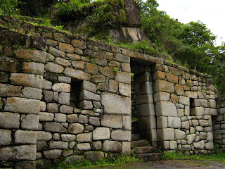
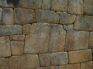
The naval of the earth according to the Incas. My opinion of Peru improved after a few days in Cusco. It´s a beautiful city with lots of colonial buildings and Churches, some build on Inca ruins. The Inca stone work in truly amazing, the blocks fitting together without gaps. Look at the photo of the 12 sided stone in the wall.


How did they do that? The Incas did not have a form of writing, so nothing was recorded and the Spanish Conquistadors had no interest but to destroy everything in there way and steal the rest to be shipped to Spain.


Cusco was a city I felt happy and safe in. The beautiful old area of San Blas, where I stayed, had security guards on the streets at night. The food was good and cheap and there was always somewhere playing live music that almost no tourists went to. One of the best bands I saw was called 'Autopista a la Luna' - Road to the moon. They played a fusion of Jazz and Andean music. Instead of a drum kit the drummer used a cajon, this is a wooden box with a hole in the back. The drummer sits on it and managed an amazing range of sounds. When you´re a travelling band with no transport a full drum kit is hardly practical. The bands were friendly, always wanting to know where we were from and telling us where they had played in Europe. It was easy to spend two weeks there, with the music, many interesting museums, Inca sites and of course a trip to Machu Picchu (in separate blog).

There are many Inca ruins near Cusco, but Saksaywaman is far by far the most impressive. High on a hill above Cusco, the huge stone blocks look impossible to move let alone be expertly carved to fit together without any gaps.


The Sacred Vallay is near to Cuscu and I visited the town of Ollantaytambo. Apart from impressive Inca ruins nearby, the town has been permanently inhabited since Inca times. The narrow streets are laid out in a grid, the lower sections made from huge Inca carved blocks. What really impressed me were the doorways of intricately fitted stone blocks having constantly been used for over 500 years.


Similar with Machupichu and nearby Pisac, the doorways are very high considering the Inca people were very small. I wish modern building were the same, it might prevent the bumps on my head.

With all the Inca ruins are the terracing on the mountain sides. Used for agriculture, to increase the available land and stabilise the ground. 500 years later they are still in good condition.

Lima

Big, dirty, scary, dangerous Lima. I had to see for myself. I booked into the Hostel España which was just off the main square. The initial feelings of paranoia quickly disappeared after walking though the main streets and finding it no different from any other big city. There were a few unusual sights; an armoured tank with machine gunner at each side of the presidential palace, many riot police and military on the streets and security guards with muzzled Doberman Pinschers. I don´t know which looked more scary.

Moving to another hostel in the safe suburb of Miraflores, was a bit of a culture shock. Miraflores felt like a modern North American city, with many shops, restaurants and a shopping complex built into the cliffs beside the Pacific Ocean. It was here that I met up with my friends, Tamara and Anika, and we planned our boat trip in the Amazon Basin.

Thursday, January 29, 2009

Machu Picchu on a Shoe String

The cheap way, the Scottish way and the German way to get to Machu Picchu. Forget the Inca trail, the alternative trails (too expensive and way too much effort), the train, my German friend Lena and I took the cheap trail.

Day 1

The bus left Cusco at 8.30am, a way more sociable time than the other options and at a cost of US$5 for the 5 hour journey, very cheap.The road wound it´s way over the mountains and over the Abra Malaga at 4315m above sea level. Dropping down the other side the bus stops and we watch a landslide in progress, cover the road with rocks and earth. With rocks still coming down the steep mountain side, people were clearing the road of debris and our bus sped though. The mountain scenery turned to jungle as the bus descended, screeching to a halt again this time to miss a petrol tanker going the other way, with a big sign on it´s roof ´DANGER INFLAMMABLE´

Arriving in Santa Maria we were surrounded by minibus touts trying to force us onto their overcrowded buses, with the threat of no more buses for 4 hours. However, after 5 hours on a bus it was time to relax and have lunch. Shortly after we were on our way again in a beat up old Toyota estate car, driver and passenger in the front, Lena and I on the back seat and a family of 4 in the boot. The old car struggled up the steep mountain road, not dissimilar to some ski field roads in New Zealand except for the 1000m vertical drop at the side. 2 hours later and US$3 poorer we arrived at Santa Teresa. The small town is surrounded by green mountains and beside the raging torrent of the Rio Urabamba, fueled by the wet season rains. The river would be our guide to Machu Picchu.

Day 2

Crossing the mighty river by suspension bridge we walked up stream past a crew of workers trying to stabilise the mountainside beside the track.


A man blows his whistle and the workers stop to allow us to pass safely. The valley sides steepened and the and the track followed the river as it crashed over huge rocks causing impressive rapids.

We had a feeling of Independence and freedom traveling through this remote land with no map and only the river as our guide to take us to our journeys end. We rejoiced in our freedom as the rain began to fall, sheltering under giant banana leaves until it stopped.


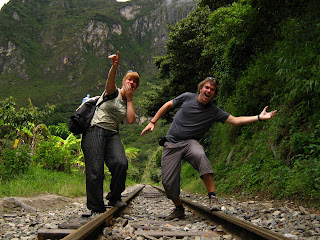
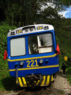
A river cascaded out from the side of a mountain high above us, it´s source a mystery. We imagined a beautiful high plateau with pristine jungle undiscovered by man. In contrast, nearby was the hydro electric station where the path ended and we would walk along a disused railway track beside the river. Disused, yeah right! Not long after a train was thundering towards us horns blaring (thanks Lonely Planet). There was no rest for the river, it was still a torrent of rapids, now surrounded by dense jungle and even higher tree covered mountains.


The railway crossed the river by a dodgy looking bridge. We stand and contemplate which route to take, the foot path with rusty loose metal plating, or on the railway sleepers, with the river in view below. We take the first option. At this point we were still not expecting to see a train coming. We thought how 'funny' it would have been if we´d walked almost all the way across on the sleepers only to have to run back when the train came....


Walking along the tracks cut into the mountainside and the river below us we spot Inca terracing on the mountainside opposite. We felt like explorers of old as we realize this is our first sight of the Lost City of the Incas, Machu Picchu. With Wainu Picchu towering above the ruins and we are in awe of the scenery and full of anticipation for the next days hike to get there.


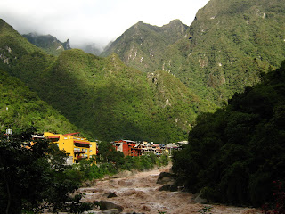
With Machu Picchu in view we knew it was not far to Aguas Calientes, our bed for the night. Chewing coca leaves along the way had eased our 5 1/2 hour passage though the jungle but left us with a fearsome appetite.


Holding out for cheap accommodation we walk to the furthest point in town to the Inti Wasi Hostel which for $5 a night fitted the bill perfectly.

Ouch, we bought our our entrance tickets, $40 each.

Day 3

Awake at 3.30am for the hike up to the ruins, but the rain was beating off the roof of the hostel and we thought better of it.

Instead we went to the Manuel Chavez Ballon Museum and learnt about the history and the discovery of Machu Picchu and had some time to read up on the history of the Incas. Yes I don´t waste all my time drinking beer and chasing girls, and since when was that a waste of time anyway.

Day 4

In the spirit of all things free, we decided to walk up to Machu Picchu and save the $7 that the bus ride would have cost. Setting off in the pitch black at 4am there was just some light rain to keep us company and a few other people doing the same thing. Climbing 450m along steep stepped paths we arrived at sunrise at the the top, 1 1/2 hours later. Although we couldn't´t see the sunrise as it was chucking it down with rain. We were there early to get 2 of the 400 (free) tickets which allow you to climb Wainu Picchu, but more of that later.
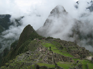
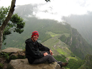
After thawing and drying out as the day warmed up I took a little walk around the ruins, up to the gate keepers house to get the classic M.P. photo. We were lucky the cloud cleared a little and there was a little blue sky. It´s a truly amazing setting in the mountains.


Risky Planet

The vertical sides of Wainu Picchu kind of make it look impossible to climb. Several warnings about being in good health, not suffering from vertigo, that the paths are scary but not dangerous and some of the paths will make the heart beat race of normal people did not put us off. We set off undeterred. Lena wanted to go to the Temple of the Moon, half way down the North face of the mountain, so we branched of the main path and found the first ladder to climb down, no problem. The narrow path wound it´s way down and round the mountain. The ruins of the Temple of the Moon I thought were nothing special but the setting in the jungle on the mountain side was really cool.


We guessed the unmarked path leading up the mountain would take us to the summit of Wainu Picchu. It did but not without some heart stopping moments. The Inca built paths are built on the side of steep slopes with dizzying drops to the side. At one point we were faced with a ladder climb up a vertical cliff followed by an narrow Inca stairway carved out of solid rock with only a wire rope to hold on to. Scary but not dangerous, yeah right, one slip or wrong foot would have lead to a fall into the jungle below and certain death. It was a long way back, we had no choice but to carry on. It would be impossible to be in that situation at home with so many safety regulations and for that reason I love travelling so much. I heard stories of people having fallen off Wainu Picchu and it taking months to find the bodies in the jungle. Respect to the Incas, they probably ran up these mountains without a second thought and definitely had no wire ropes to hold on to. The view at the top of the ruins of Machu Picchu was worth the climb but the route down looked pretty terrifying. It´s easy walking down the stairs in your house, but when these stairs are narrow, far too small for your feet, slippery from the rain and you can see the bottom of the valley at least 500m right below you it makes things just a little tricky. Did I once used to suffer from vertigo?


Stairs handled we were soon back to Machu Picchu. With only 1/2 litre of water and a handful of coca leaves between the two of us we´d been hopelessly unprepared for what turned out to be a 3 1/2 hour hike, but fortunately it all worked out fine.

Walking round the ruins late in the day most of the tour groups had departed. I got chance to feel the peace and silence that prevailed over the site for nearly 400 hundred years from when it was abandoned to being rediscovered in 1911. The Inca people who built this site were incredibly skilled, the stone work is amazing.


I left the site at 4.30pm feeling that I could spend another day there, there were still areas I had not seen. I think I tapped into some mystical Inca energy because after all that hiking I still walked back to Aguas Calientes instead of taking the bus (or was that mystical Scottish tightness).

Machu Picchu gets the number 2 spot in the 7 Wonders of Brainworld, with The Temples of Angkor in Cambodia still in first place. I´ll definitely visit Machu Picchu again and maybe do the Inca Trail.

Day 5

Retracing my steps along the railway line to the hydro electric station I made the mistake of taking one of the 'direct' mini buses to Cusco for $13. It ended up taking longer than if I´d taken the public buses. To add to that the driver was clearly insane, finding the smoothest part of the dirt road to drive on regardless if it was on the wrong side of the road, on a blind corner, and not slowing down for pedestrians, animals, towns or anything. Maybe this was just the Peruvian way of driving. Then there was the dead tourist on the road having just been run over by a truck going the other way. This road is used by the jungle mountain bike tours to Machu Picchu. More dangerous than than Death road in Bolivia I think. The poor tourist had not even got as far as seeing Machu Picchu, I still didn´t know if I´d get to tell the story. After 12 hours journey from Aguas Calientes, I arrived safely in Cusco.

Saturday, January 17, 2009

Tales from the Gringo Trail (Part 2)

Bolivia

Leaving the bus terminal I bumped into a Mexican traveler, Roberto, and we walked to the border crossing. Later I discover he is a TV celebrity in Mexico, a kind of Mexican Steve Urwin. The crossing from La Quiaca in Argentina to Villazon in Bolivia was quick and easy. The immigration offices are less than 30 metres apart and arriving at lunch time gave me plenty of time to cross and then buy a train ticket to Tupiza.

Villazon was like any border town I've been to. Narrow streets lines with currency changers and many clothes shops. At 3600 metres altitude the air was a bit thin and a few coca leaves were needed to stave of the tiredness.

Great Train Journeys of the World

The clean and modern train departed from Villazon on time at 3.30 in the afternoon. The first part of the journey was through desert like scenery and scrub. The tracks were very uneven and progress was very slow. Dropping 500m metres we were suddenly in a different world. Towering, eroded red mountains, lush green vegetation and the river next to the railway running red from the iron deposits. In the railway carriage the TV screen was showing the latest 'Mummy' film which was completely at odds with the splendor of the scenery outside. An incredible but short journey of only 3 hours with the train arriving in Tupiza on time. The train continued to Uyuni and Oruro but at night and at an altitude of over 3000 metres this is maybe not so enjoyable.

The Land That Time Forgot

After almost a year and a half of travel I´ve already used all the words I can to describe scenery and landscapes. I´ll have to use them all again but now with ten times the meaning for the landscapes in Bolivia. They are really that amazing(x10). An incredible surprise!

From Tupiza it was a 4 day jeep trip to Uyuni to see the Salar de Uyuni. The worlds largest salt flats. With my three new friends, Roberto, Carly and Judy, we had hired a jeep with driver and cook for the trip.


Departing from Tupiza early the next day the old Toyota Landcruiser struggled up the steep mountain road out of Tupiza, battery terminal coming off making the jeep suddenly stop and finally over heating at the top. No problem our driver was a top class mechanic, using muddy water from a puddle for coolant he had it all sorted while we took photos of the scenery. For some reason we all had complete faith in our driver and jeep for this 4 day journey to the back of beyond. Our drivers skills were again shown fixing a puncture, using an axe the on the wheel's split rims.


The journey took us up to the snow line and down past small towns and nearby mines, herds of llamas. Passing colourful lakes and rainbow coloured mountains I would not have been surprised to see hunter gatherers chasing long extinct animals.


Travelling through this alien landscape I arrived at Lagoona Colarada. If this was an alien landscape, the flamingos were the perfect alien birds. The bright pink birds feeding from the red lake, red and yellow mountains behind, if I´d have seen this as a photo I´d have thought the colours had been changed on it.


Before we reaching the salt flats we cross the railway that links Bolivia to Chile the coast. Bolivia lost the War of the Pacific against Chile and as a result has no coast line. The Chileans built the railway from the coast to Bolivia as a consolation to allow trade to the sea. Bolivia still disputes this loss of land. The Bolivian Navy is now restricted to patrolling the waters of Lake Titicaca.
Millions of years ago when South America was flat, Atlantic Ocean reached far into the continent. With the action of the earths plates and the formation of the Andes part of the sea was enclosed by mountains and lifted up to a height of 3500m. The water evaporated and Salir de Uyuni was formed. The largest salt flats in the world. Climbing on the rocks at the edge of the salt flats it was amazing to find the rock were in fact coral from the sea that was once here. On top of the coral was lava from the many surrounding volcanoes.


We were up 5am to drive out onto the salt flats and see the sunrise. With the cold temperatures and white everywhere outside it felt like we were driving through snow.


Bad bus trips of the world

The bus journey from Uyuni to Potosi was entirely on 'dirt roads' and sometimes using convenient dry river beds, a roller coaster of a trip through the mountains. Along the side of the bus was written 'Comfort Security and Elegance'. This I found highly amusing on this 20 year old bus with luggage on the roof, no leg room and the aisle filled with people standing for most of the six hour journey.

Potosi

Bolivia was full of surprises, Potosi at 4060 metres above sea level is the world's highest city, I was expecting a drab and bleak city. I was greeted by a city of elegance, colour and vibrancy. Once the richest city in South America in Spanish colonial times, created from the nearby silver mines in the mountain that towers over Potosi, Cerro Rico.


The mines financed the Spanish Empire for over 200 years. The mountain has the name 'The mountain that eats men alive'. Maybe as many as 8 million people have lost their lives in the mines in Potosi, mostly indigenous people and African slaves who were forced to work for 20 hours a day in appalling conditions. People work in the mines today, still in medieval conditions. The mines are full of toxic dust and silicosis is a major problem, once the miners contract this illness they only live a few years more. The American film 'The Devils Miner' made in 2005 shows the life of a 14 year old boy working in the mines, watch it and you´ll see what I saw here. I took a trip into the mines and was horrified with the conditions. Walking through unlit tunnels climbing ladders into a tiny enclosed space, I watched a miner hammering at the rock to create a hole for a stick of dynamite. I was almost suffocating from the lack of air and the dusty atmosphere. I was told by the guide that this miner would work here for 10 hours he and was already dying from silicosis. The miners chew on coca leaves which helps them deal with the conditions. Below ground they pay homage to the god 'El Tio'.


The Spanish mine owners created this god to scare the indigenous workers. They give alcohol, cigarettes and coca leaves as an offering to El Tio in return for his protection. We took gifts for the miners and their children. The families live beside the mines so they can stop their equipment from being stolen.


The Cerro Rico was once 1000ft higher and it is now forbidden to remove material from the summit, so the city´s landmark doesn´t disappear forever. Last year 15,000 miners were working in the mines but now there are only 5,000 due to falling mineral prices and as a result mining is no longer the main industry in Potosi. A far cry from the colonial days.

Later when visiting the Casa de la Moneda (The Royal Mint museum) it is very ironic that after years of Bolivia producing coins for Spain, Spain now produces some of the coins for Bolivia. Inside the museum, the giant wooden machinery used to produce the strips of silver for the coins was perfectly preserved by the high altitude. When the mules which powered the machines died, they used slaves from Africa instead.

Risky Planet

Sucre had been the scene of recent riots and fighting. On the streets there was no evidence of this and the city had returned to normal. Country people fighting with town´s people fighting with the police. A complicated situation that I can´t begin to explain. Bolivia is a divided country on many levels, geographically, politically and ethnically. The majority are indigenous people, who are poor and live in the highlands. The rich minority live in the lowlands that include the mineral rich areas of Santa Cruz and Tarija and are of Spanish desent. El Presedente Evo Morales (the first indigenous president) was discussing redistribution of wealth from the lowlands to help the large population of poor people in the highlands. This sparked a revolt in the lowlands with rioting and talk of the separation. A referendum was announced and the country was at peace.

Travelling through the highlands of the country he has almost complete support, every building has Evo painted on the side of it and a big tick.

Sucre is the Judicial Capital of Bolivia and has many fine buildings all white washed. It´s a fantastic city and not at all what I expected to find in Bolivia!


Happy that Sucre was a safe place, for the time being, I decided to make it my home for Christmas and New Year. I would also be away from the back packer hoards in the bigger towns. I contacted the Fox Language Academy and enrolled for more Spanish lessons and also volunteered as a classroom assistant to help teach English to under privileged people. The school is non profit making and the money I paid for Spanish lessons helped to pay for under privileged people people to learn English.


I spent Christmas Eve at the house of the School's director with his family and friends eating traditional food. Christmas Eve is a sober affair in Bolivia, New Year's eve is when they party. My Spanish teacher had asked me if I wanted a lesson on Christmas day, I was a bit surprised but agreed when she told me her husband was unemployed and she needed money to by her children presents.

The out stretched hand begging for money was an all too common sight in Sucre. The poor people go to the main square on Christmas morning hoping to be given food or anything. A few of us at the hostel grouped together to buy some food to give out there.

On New Year´s eve there was a big celebration in the square with music organised fireworks and more concerning, everybody elses fireworks. It was 200 hundred years since the start of the revolution against the Spanish colonialists.

La Paz

Arriving to La Paz by bus is one of the most amazing way to arrive to the city. Driving along the edge of the high plateau the whole of La Paz can be seen in the valley below. It´s almost like flying into the city. It´s an incredible city, very busy with chaotic street markets everywhere. Culturally interesting with very high quality museums and art galleries.

The Coca Museum was very informative about the indigenous peoples use of the coca leaves. The leaves act as a mild stimulant, allow you to work longer and stave off hunger. They are also nutritious and help the effects of altitude and are not addictive. The indigenous people have used the leaves for thousands of years and it is part of their culture. I personally found a cup of coca leaf tea in the morning most enjoyable. The USA is trying to eradicate all coca plants in South America because of their use in the manufacture of Cocaine. Evo Morales (an ex coca plant farmer himself) has expelled the US Drug Enforcement Agency from Bolivia with the reasoning that the cocaine abuse is a problem of the USA not Bolivia.

Each afternoon there were demonstrations along the main street. Camposinos (country people) marching with shirts off, flying the multicoloured indigenous flag and letting off homemade fire crackers. It sounded like a war zone and the police were out in force with riot shields. A sinister squad of police motorcyclists prowled the streets with the pillion holding a rubber bullet gun with a fearsome stack of ammunition on the waist. We´re told to avoid political demonstrations in case they turn nasty but this was irresistible to watch.


The World´s Most Dangerous Road

Quite a claim. Built by Paraguayan prisoners of war in the 1930's it was once the only road between La Paz and Coroico. Ironically the Paraguayan´s are still managing to kill Bolivians long after the war was over. Before the road was 'closed' to traffic an average of 100 people were killed every year. I had seen photos of the road with trucks passing each other and massive drop offs at the side of the road. A new road has been built now and the road is 'almost´only used for down hill mountain biking. 64km long with a vertical drop of 3345m.


Not recommended in January and February due to the rainy season and resultant landslides, but what the hell, it couldn´t be that bad and there was no way I was going to miss this opportunity. Kitted out with super cool down hill mountain bike, with massive suspension travel, disc brakes, tyres that wouldn´t have looked out of place on a motorbike and a full face crash helmet the 'Downhill Madness' was to commence. 24KM on tarmac loosing 1000m then 4km up and down. These beasts were not designed for going up hill, undeterred 4 of us cycle the section, the rest go in the minibus. We reach the 'death road' itself, a dirt road with no crash barriers, many crosses mark where people have died. Exciting stuff.


The Corners of Death being the most exciting with the road cut into near vertical cliff with 100´s of meters of drop to the jungle below. Waterfalls cascaded over the road. All very safe though, we only meet one jeep going the other way. Without traffic it´s now pretty safe, the guide kept the speed down and I found the bikes weren´t geared for flat out speed, but I guess the consequences of crashing could have been fatal. The scenery was amazing, the experience of cycling though the mountains of Bolivia was unmissable and riding a Rockymountain DH bike worth $3500 was awesome.


On route to Peru was Lake Titicaca and the Isla del Sol (Island of the Sun) important in Inca mythology as the birth place of the sun. A tranquil island to spend a day or two and it´s incredibly beautiful. A fitting end to five weeks of travel in Bolivia where I found the people friendly and welcoming and the country was generally safe to travel in, but maybe I´d been lucky again.

Since leaving Bolivia I learned that Evo Morales has won the referendum to change the constitution in favour of the majority, the indigenous people. In Sucre I witnessed the NO campaign with posters likening Evo Morales to other South American dictators such as Pinochet and Hugo Chavez. He may not be perfect but having seen the poverty at first hand in Bolivia I cannot argue against his reasoning to help the poor majority. I hope and wish for peace and prosperity in this beautiful country.